Using Physical Maps
אוג׳ 2016 · Lerner Publications ™
ספר דיגיטלי
40
דפים
family_home
כשיר
info
reportהביקורות והדירוגים לא מאומתים מידע נוסף
מידע על הספר הדיגיטלי הזה
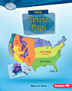
Have you ever wondered which countries have the most lakes? Or where the highest point in your state is? Physical maps show landscape features. They also often show land elevation, or how high the land is above sea level. But how do you use physical maps? And what do the different colors and symbols on these maps mean? Read on to learn all about physical maps!
על המחבר
Rebecca E. Hirsch is an award- winning children's author with a PhD in plant biology. Her picture books include Plants Can't Sit Still and Night Creatures: Animals That Swoop, Crawl, and Creep while You Sleep. She lives with her husband and three children in State College, Pennsylvania. You can visit her online at rebeccahirsch.com.
רוצה לדרג את הספר הדיגיטלי הזה?
נשמח לשמוע מה דעתך.
איך קוראים את הספר
סמארטפונים וטאבלטים
כל מה שצריך לעשות הוא להתקין את האפליקציה של Google Play Books ל-Android או ל-iPad/iPhone. היא מסתנכרנת באופן אוטומטי עם החשבון שלך ומאפשרת לך לקרוא מכל מקום, גם ללא חיבור לאינטרנט.
מחשבים ניידים ושולחניים
ניתן להאזין לספרי אודיו שנרכשו ב-Google Play באמצעות דפדפן האינטרנט של המחשב.
eReaders ומכשירים אחרים
כדי לקרוא במכשירים עם תצוגת דיו אלקטרוני (e-ink) כמו הקוראים האלקטרוניים של Kobo, צריך להוריד קובץ ולהעביר אותו למכשיר. יש לפעול לפי ההוראות המפורטות במרכז העזרה כדי להעביר את הקבצים לקוראים אלקטרוניים נתמכים.