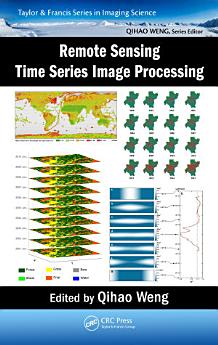
Remote Sensing Time Series Image Processing
关于此电子书
Divided into three parts, the first addresses methods and techniques for generating time series image datasets. In particular, it provides guidance on the selection of cloud and cloud shadow detection algorithms for various applications. Part II examines feature development and information extraction methods for time series imagery. It presents some key remote sensing-based metrics, and their major applications in ecosystems and climate change studies. Part III illustrates various applications of time series image processing in land cover change, disturbance attribution, vegetation dynamics, and urbanization.
This book is intended for researchers, practitioners, and students in both remote sensing and imaging science. It can be used as a textbook by undergraduate and graduate students majoring in remote sensing, imaging science, civil and electrical engineering, geography, geosciences, planning, environmental science, land use, energy, and GIS, and as a reference book by practitioners and professionals in the government, commercial, and industrial sectors.
作者简介
Dr. Qihao Weng is the Director of the Center for Urban and Environmental Change and a Professor of geography at Indiana State University, USA. He was a visiting NASA Senior Fellow (2008-09). Dr. Weng is a Guest/Adjunct Professor of several major universities including Peking University and a Guest Research Scientist at Beijing Meteorological Bureau, China. He received his Ph.D. degree in geography from the University of Georgia in 1999. At the same year, he joined the University of Alabama as an assistant professor. Since 2001, he has been a member of the faculty in the Department of Earth and Environmental Systems at Indiana State University, where he has taught courses on remote sensing, digital image processing, GIS, environmental modeling, and urban studies, and has mentored 15 doctoral and 13 master students. Dr. Weng’s research focuses on remote sensing and GIS analysis of urban ecological and environmental systems, land-use and land-cover change, environmental modeling, urbanization impacts, and human-environment interactions. He is the author of over 200 peer-reviewed journal articles and other publications and 10 books. According to Web of Science, his publications have been cited by others 4,280 times with H-index of 35. His Google citation yields over 10,000 times. Dr. Weng has worked extensively with optical and thermal remote sensing data, and more recently with LiDAR data, primarily for urban heat island study, land-cover and impervious surface mapping, urban growth detection, image analysis algorithms, and the integration with socioeconomic characteristics, with financial support from US funding agencies that include NSF, NASA, USGS, USAID, NOAA, National Geographic Society, and Indiana Dept of Natural Resources. Dr. Weng was the recipient of the Robert E. Altenhofen Memorial Scholarship Award by the American Society for Photogrammetry and Remote Sensing (1999), the Best Student-Authored Paper Award by the International Geographic Information Foundation (1998), and the 2010 Erdas Award for Best Scientific Paper in Remote Sensing by ASPRS (1st place). At Indiana State University, he received the Theodore Dreiser Distinguished Research Award in 2006 (the university’s highest research honor) and was selected as a Lilly Foundation Faculty Fellow in 2005 (one of the six recipients). In May 2008, he received a prestigious NASA senior fellowship.